I have tried to sit down to write these last few entries several times, each to no avail. I was too tired, or uninspired, or too busy savoring every last drop of time with my family on the trail. Once I returned home I found that I couldn't remember specifics: what was the name of the shelter? What lake did we stop at? And I was remiss to write anything short of excruciatingly thorough for my last entries into what has become the most effective outlet and means to share my adventures I could possibly imagine. Thankfully, yesterday I happened across something that my dad must have purchased while I was away: a brand new AT Guide - in pristine condition, without any wear from the weather and with every page still intact. Flipping through the pages I realized that looking at the topography map was as almost as good as a flashback to the trail. I remembered those hills, descents, ponds and shelters and finally - finally - am able to sit down to finish this adventure.
Day 1
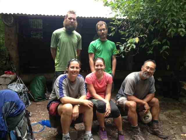
After a restful evening at the Lakeshore House, Red Knees and I awoke early, eager to return to the trail and begin our slow trudge into the Hundred Mile Wilderness, our packs laden with more food than we should have realistically been carrying and our stomachs still uneasy with the aggressive amounts of town food ingested the previous day (I now know how much Ben & Jerry's truly is too much). Thankfully we were able to obtain a ride to the trail head from one of the owners of the hostel and we were ready to start walking at 8:00am.
The terrain for the day was bumpy to say the least, full of 100 to 200 foot ascents and descents, creating a mini roller coaster which we were fully prepared to be exhausted by. Thankfully, the terrain was amenable and we were able to make quick time over the hills. After a quick snack at Leeman Brook Lean-To where we ran into, what I assume were, a bunch of day or section hikers, we pushed on, fording streams and stumbling over roots. When we came to our first stream that required "fording" (I put this in quotes because it really just required a half-assed hop) I stopped to grab something from my pack. When I looked up, Red Knees has his arms submerged elbow deep in the water with a frantic look on his face. For some reason, when he pulled something out of the stream I assumed that he had caught a fish with his bare hands and I was in awe until, of course, I realized that it was his iPhone that he held dripping in his hand. Oh boy, R.K. We looked at each other terrified for a moment until he was able to remove it from the "Life Proof" case and determine that it was, in fact, life proof.
This would not be Red Knees' only traumatic water encounter for the day. About 7 miles later we arrived at Wilber Brook, just down the hill from the shelter and our final destination for the evening, a short 15 miles from Monson. I was able, with the aid of my trekking poles, to very handily rock-hop across the quickly flowing river but after a few minutes of surveying the possibilities Red Knees decided to shed his shoes and stomp across, just to be sure he wouldn't get his shoes wet. He also decided, however, that it would be easier to cross without holding his shoes so that he would be able to use his hands. Sitting on a rock on the far bank of the river I cautioned: "Don't throw them R.K., that's a really bad idea..." He threw the first shoe across.
Of course, instead of landing safely on the bank, the shoe arched up and caught in the branches of a tree overhanging the river and dropped straight down into the water. The fact that they were wet at this point was completely overshadowed by the fact that the shoe was caught in the current, floating dangerously quickly out of sight. I dropped my things and ran to the waters edge to try and keep the shoe in sight. Panicking, Red Knees picks up his other shoe and ALSO throws it across the river and, predictably, that one falls straight into the water as well but thankfully catches on a rock. Red Knees then proceeds to sprint through the river, up to his waist, and once he was within 5 feet of the escaped footwear, dives in a particularly ungraceful belly-flop to successfully grab the shoe. So much for not getting wet in fording the river.
That evening we reconvened with Chaos, Timex, Whistler, Pumpkin Head, Spacey, Fabio, Steady State, Danno, OB, Fancy Pants and the rest of the crew at Long Pond Stream Lean-To, the last shelter before we would head up into some of our final mountains the next day. Amazingly, not one but two people decided to pack out the fixings for s'mores so we feasted on burnt mallow goodness around a roaring fire until well into the night.
Day 2
The next morning we set out on a 20.8 mile adventure over the first set of mountains in the wilderness though we expected them to be the tamer of the two ridges based solely on idiocy and the topography map. The first climbs to the top of Barren Mountain were fine - steep but manageable - and we arrived at the side trail to Cloud Pond Lean-To relatively quickly. Then the trail became a nightmare. There were steep ascents and steeper descents that did not appear on the map and the roots and rocks dug into our feet and threatened to throw us off balance as we descended off of Fourth Mountain (yes, so awful that they couldn't even think of a name for it. Mind you, there is a third mountain, but no first or second). At one point, the mountain succeeded and my foot slipped completely out from under me and I fell not backwards, but forwards, somersaulting feet over head down the mountain, landing painfully on my butt. I let Red Knees lead the charge for the rest of the day.
The miles seemed to drag endlessly as we continued to struggle over the difficult terrain, finally arriving at Chairback Gap Lean-To for lunch before descending down out of the hills. Red Knees, Danno and myself were briefly joined by Timex who opted to stay and wait for Chaos when we continued walking. Finally, after a remarkably rocky descent off of Chairback we came to Pleasant River, an easy ford just before the very well-trafficked area surrounding Gulf Hagas (the Grand Canyon of Maine!) After our ford we stopped briefly to speak with a Ridge Runner who informed us that the mountains the next day would not be anywhere near as brutal as what we had traversed today. Thank God.
The final five and a half miles were a gradual climb over beautifully maintained trail to take us up to the Carl A. Newhall Lean-To where Raider, a fellow hiker and ex-Marine, had saved us space in the shelter by, essentially, evicting several section hikers. No complaints here. We set up and waited for everyone to arrive but many of our crew did not show up, having decided to sleep a mile or so back after the challenging day. We slept like babies, yet again.
Day 3
Finally, we had arrived at the final mountains of the trail - the range leading up to White Cap Mountain from the top of which (allegedly) you are able to get your first real views of Katahdin. Of course, when we set out the fog was hanging low, obstructing our views to at most 50 feet in front of our faces. We were prepared for grueling climbs up the four peaks but, thanks to some truly spectacular trail maintenance (thank you, stone stairs!) we were able to fly up and over the mountains in great time. When we finally arrived at the summit of White Cap it was locked in fog and freezing, the rocky terrain around us looking distressingly like the bottom of the ocean with the hazy skies hanging low. Needless to say we did not stick around to see if, perhaps, the fog would lift to reveal views of that glorious final mountain (it didn't).
We basically ran the rest of the day, eager to put in the miles and get to the flat land that awaited us for the final 60 miles of our adventure (save, of course, Katahdin) and we arrived at Cooper Brook Falls Lean-To at around 3:30pm. When we arrived, two thoroughly tattooed section hikers were there with a fire blazing, preparing to cook fresh caught fish from the roaring stream just in front of the shelter. As they were questionably cleaned I decided to avoid the fish but we spent a good part of the evening waiting for our hiking buddies to show up and tending to the fire. Again, we feasted on s'mores with the leftovers remaining in our friends' packs. Not too shabby.
Day 4
Flat. So flat. The trail was covered pretty extensively with roots that threatened to snap your ankles in half but we had only one climb that was over 100 feet and it was over, more or less, before it started. Halfway through the day we arrived at Potaywadjo Spring Lean-To and stopped for an extensive lunch break - we had completed 10 miles in 3.5 hours and had the rest of the day ahead of us. The spring at the shelter was perhaps the most beautiful water any of us had seen on the trail - the spring bubbled up straight from the ground with ice cold, clear, untouched water. We filled our bottles and guzzled the water straight without bothering to purify.
Arguably the greatest part of the day happened just after we passed Antlers Campsite about 8 miles into our day. As we walked along the edge of Jo-Mary Lake we saw a small wooden sign nailed to a tree that pointed to the east. Approaching it my pace quickened as I realized what it said: "View of Katahdin". I unbuckled my hip-belt while running and threw my pack to the ground, almost falling as I tripped over partially submerged rocks in the lake. When I turned to the left and saw that behemoth of a mountain, rising gloriously like a god, arching his back under the skin of the earth, I was speechless. All I could do was raise my arms in the air in victory as a single tear found its way down my cheek. I brushed it away quickly.
Finally - FINALLY - after all of this time, there she was, rising in the distance. For so long we had all kept our thoughts of Katahdin at bay, knowing full well that you cannot think about the end too soon for fear that it will become overwhelming and now, seeing our final destination in the distance, we allowed every thought that we had previously pushed from our minds behind the dam of cognizance to come rushing forward into the forefront of our minds. It now makes sense to me why people quite literally begin to run on the trail once they have the greatest mountain in their sights.
The remainder of the day was uneventful and full of roots. Thankfully towards the end of the day the trail took us straight across some sandy beaches on the shores of Nahmakanta Lake - a big, beautiful lake that stretches for miles with several incredible views of Katahdin. After dropping our packs at the shelter a half a mile further, Red Knees and I ventured back to sit by the lake and soak in the beauty of the wilderness for one of the last times on this trip, burying our feet in the sand and almost enjoying watching the bugs dance over the glassy surface of the lake.
Day 5
Our final day in the hundred mile wilderness started early, with Danno, Red Knees and myself setting out just before 8:00am. We began with a steep climb up Nesuntabunt Mountain for an incredible payoff of stunning views of Katahdin, only 16 miles as the crow flies from where we were. The weather was temporarily nice but we knew that a storm was rolling in quickly so we avoided long breaks at all costs. This, however, meant that I was essentially sprinting to keep up with Danno as he tore down the path to Rainbow Stream Lean-To. When we arrived at the Lean-To I made the decision to push on that day all the way to Abol Bridge Campgrounds because I did not have enough food to happily complete the hundred mile wilderness. Red Knees agreed and we took off death-sprinting, as we are prone to do.
Thankfully the trail was largely flat and we moved at almost a 4 mile an hour pace along the shores of rainbow lake until we arrived at the base of Rainbow Ledges where there promised to be a magnificent view of Katahdin, though we feared that it would be covered with some ominous clouds rolling in. About halfway up the climb I had to stop to relieve myself and I told Red Knees to press on - I would meet him at the top. Relieved, I continued up the mountain for about 20 steps when I heard a noise in front of me that seemed out of sorts. I looked up.
MOOSE. Not just your run of the mill cow or a small bull. This was the granddaddy of all moose coming in at least 8 feet tall and probably weighing well over a ton with a rack of antlers that spanned at least 4 feet standing perpendicular to the trail, mindlessly munching on some twigs. I froze. There was absolutely no way around this moose as he was covering the entirety of the trail and the last thing that I wanted to do was startle him into a charge. Just in case, I raised my trekking poles so that the pointed tips were facing the moose. It wouldn't do much but I figured having my poles in attack position would at the very least make me feel better.
What felt like an hour later (real time: probably a minute and a half) the moose still had not moved so I decided to make my presence known by gently tapping my poles together. Immediately, he swung his head around and stared at me dead on. I closed my eyes, naturally, to avoid making eye contact and spurring him on to charge. Once deciding that I was a bore, he went back to eating and I, now petrified, with poles still in attack position, moved slowly off to the side of the trail behind the safety of a boulder. Unfortunately, this move was ill-advised as it meant that I was walking across the lichen which was crunchier that walking on dozens of bags of potato chips. Again, the moose swung his head around and looked at me, taking several menacing steps in my direction. I cowered.
Eventually, the moose either tired of his snack or, more likely, ate it all, and began to move across the path and into the forest (of course, not straight across, but slightly towards me, to add to my building terror). Once he had cleared the path by at least 10 feet I emerged from behind the boulder and began to tip-toe up the path until I was just past him at which point I broke out in a dead sprint up the last climb of the trail. When I arrived at the ledges, panting, Red Knees was checking his phone and looked up at me with a look of: "it took you THAT long to go pee?" Of course, I instantly relayed my near-death experience to him and successfully made him super jealous that he had not also seen this glorious moose.
If only I knew what was coming next. On the way down the ledges, the skies darkened and began to crackle as thunder and lightning ripped across the sky. It began to pour, washing the sweat from my brow into my eyes causing the salinity to burn my eyes to the point at which I could hardly keep them open. I removed the bandana from my hair and used it to dry my eyes but I still spent almost half of the descent with one eye closed. As we walked the storm got closer and the cracks of thunder became louder until it was so close that one clap actually sent a shock through Red Knees' trekking pole and seemed to encompass us from all sides. When we finally arrived at the shelter, soaked through, petrified and chaffed to all high heaven, we decided it was time to eat the rest of our food and push on quickly through to Abol Bridge which we did in record time.
That evening we feasted in the restaurant, purchased a few scant items for resupply to help us make it through the next 14 miles and enjoyed the stunning views of the mountain just a few miles off. Last push: here we go.